100 Stories
Walking the Heavenly Gods’ Mountain Pass – An Incredible Nature Hike Within City Limits
036 / 100

There are locals who like to refer to them as the Ushita Alps. Far more traditionally, and my own preference, the Japanese on several of the map signboards refers to it as the “Heavenly Gods’ Mountain Pass.” Parts of it also overlap with the Futaba no Sato Promenade of History (Historical Walking Course). Whatever name you want to give it, however, if you are a hiker and nature lover who occasionally just wants to get away from the city, there is an amazing getaway that is, in fact, in walking distance of the city: a seven-kilometer hiking trail through the multiple mountains that form the northern edge of Hiroshima City proper.


It’s a little stunning, really, the existence of these trails. Is there any other major city in the world where you can hike for seven kilometers through dense foliage that blocks much of the sun, but is not even a short drive from the city center, but rather, a short walk? Personally, I’m running all the major cities of the world through my head that I can think of and can think of none to match. My own hometown, Cleveland, Ohio in the United States of America, is renowned for its “Emerald Necklace,” a vast expanse of protected metro parks that circle the city, preserving nature and greenery of great wonder. But if you are downtown, you still need a car to reach them. Here, in Hiroshima, you can be at one of several trailheads in roughly a 15-minute walk. By 30 minutes you’ll be high up the hill and deep into forested land. Amazing.
It’s also very, very pristine, because even locals rarely use it. A random polling of many of my Hiroshima-born native Japanese friends unscientifically gave me data that over half were not even aware that the trails existed, and of the minority who were aware, perhaps 10% had ever hiked it themselves. To be fair, to my upbringing “hiking” is an easy stroll through relatively flat areas with some gorgeous nature. In most of Japan, and here in Hiroshima, as well, “hiking” is fairly synonymous with “mountain-climbing.” (Point of clarity – the true Alps in Europe average 2,500 meters in height. This trail won’t take you above 250 meters, one-tenth the height. They are mountains, but…) If you want to experience these trails, expect some steep ups-and-downs, and thighs and calves that are sore the next day depending on your age and experience. If exertion is not your thing, there are less strenuous activities to explore. That said, in Hiroshima the largest age group of “hiker/climbers” is 60-plus. It’s a favorite retirement activity, so please don’t let me scare you off. The scenery and effort are well worth it.
Choosing A Course
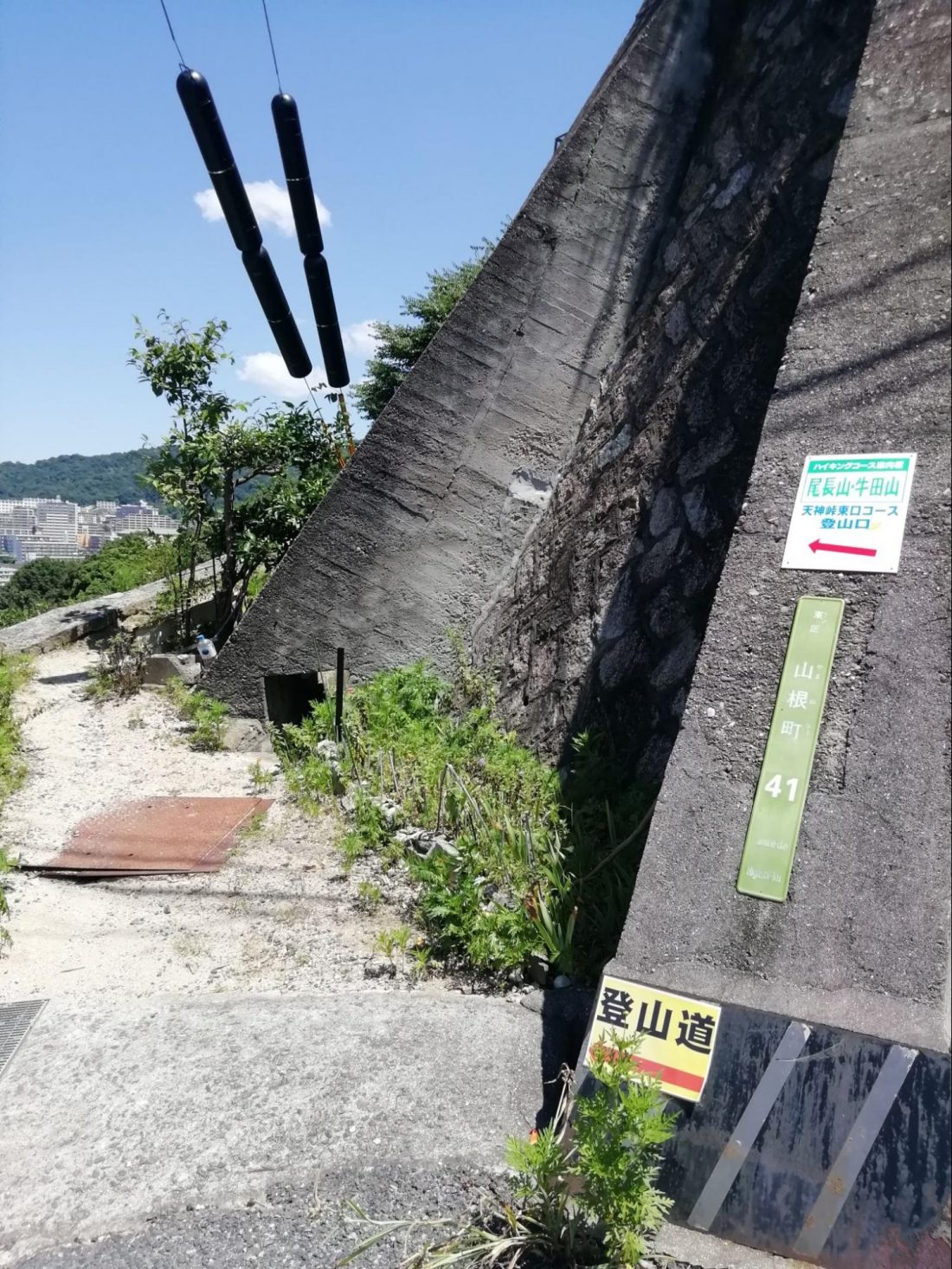
Let’s get to it. The first step is to choose a trailhead. There are multiple options but remember that you’ll also need to be planning for where you’ll come out at the end of your hike because it is not a full loop. You’ll be ending fairly far from where you started unless doubling back and doubling your distance is your plan (not advised). So where to start? The map I have of the full course (found online through the city of Hiroshima’s web page, but all in Japanese) indicates at least 10 different access points to this same stretch of trails, generally from multiple sides of each of the various mountains involved. For myself, I was able to locate a trailhead that was actually just a 10-minute walk from my own home. (Actually, the exit point I used is about a 15-minute walk in the opposite direction as the trail doesn’t loop but does crescent). However, both of these trailheads are so poorly marked as to almost not be believed. The surprise that even natives often don’t know of these trails is lessened somewhat by seeing how little they are promoted and marked.
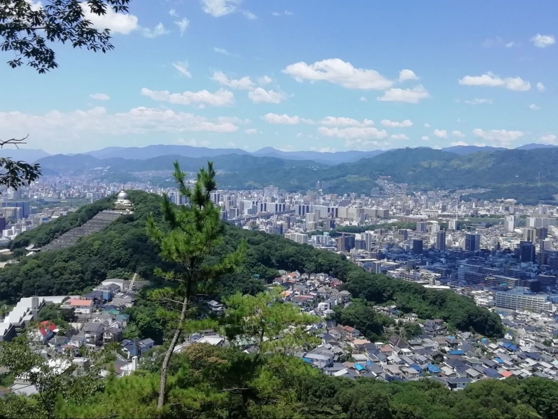
For someone visiting Hiroshima, direct and simple is best. The primary access point to these trails is through Toshogu, which is a shrine visible from the north (Shinkansen exit) side of Hiroshima Station, and just a 10-minute walk away. This access point allows you to see one of the most historically significant shrines of Hiroshima, as well as my own personal favorite shrine, just slightly further up the hill, before reaching the main trails. Soon after, you’ll reach one of my favorite city-view vantage spots also. The advantages make this the clear route to take, so we’re off.
The Peace Pagoda Starts the Real Hike
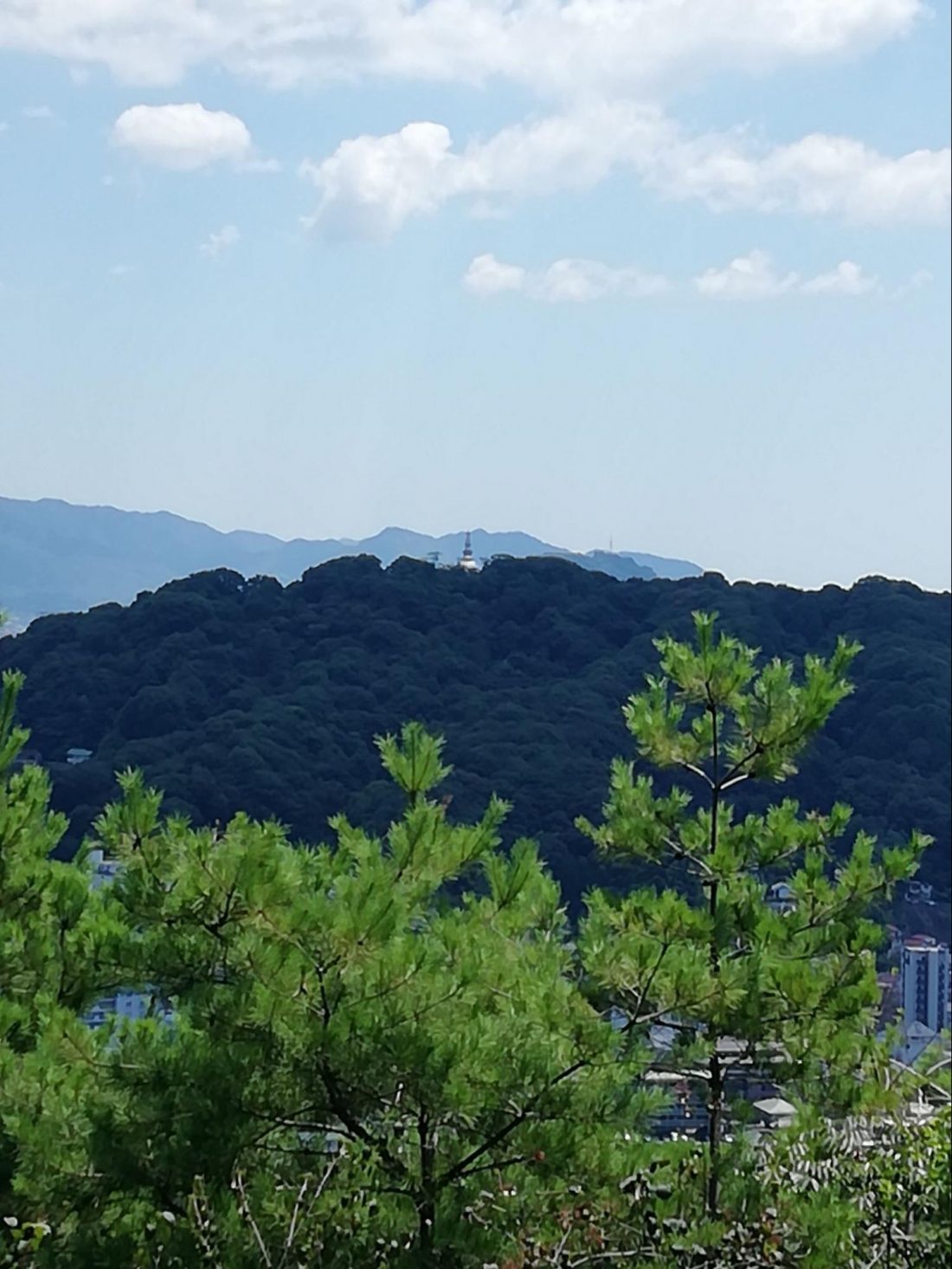
For a beginner or family with smaller children, or if you just don’t have a half day to spend in the mountains, just hiking up to the Peace Pagoda alone is a wonderful little hike. It takes you up through two historically important shrines (which are described in more detail elsewhere) but then gives you another 20 minutes or so climb through the trees and over some rocks. You will finish at the Peace Pagoda, small white pagoda-esque tower (also described in more detail elsewhere). This lovely structure can be seen from the station, and quite far in many directions. In fact, when you reach the next summit to the east, you’ll be able to look back and see it, and when you reach your final summit at the end of the hike you’ll find you are now looking at it from the west, so the tower really brings the hike together in a very satisfying way.
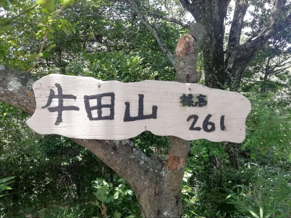
Now, the true start to your hike begins after the tower, and this is the most confusing and difficult part of the journey. The signboard at the tower and all maps seem to imply that the trail simply continues on from the tower to the next mountain. It does not. What you need to do is begin the descent down the access road to the tower, watching for a tiny bit of asphalt that turns left, just as the main road is turning right. It’s only about a one-minute walk, but it’s far enough to shake your confidence. That asphalt to the left will quickly become what seems to be the trail again, but then more confusingly become stairs down to a street of houses. Don’t be alarmed. Go down the stairs and straight up the road. As it bends to the left and climbs, you’ll see a sign announcing the trailhead – but quite small and in Japanese only (see above). The actual trailhead sign is even smaller and seems to be a mistake. It’ll point you to the narrowest of paths along a wall that will turn to become a scrap of path along the fence of a parking lot. Fear not. Just past the fence you’ll enter trees and suddenly find the real path and start your climb.
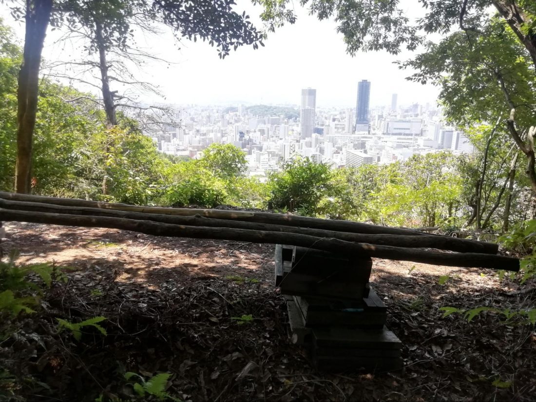
In fact, you’ll truly climb here. This is probably the steepest part of the entire trail. A rocky path (occasionally boulder-sized) will climb rapidly, taking you rather quickly to the summit of Onagayama (or Mt. Onaga) at 185 meters (606 feet) above sea level. Kindly, there is a rope strung along the trail at the steepest stretches if you need a pull of help. The view back at the Peace Pagoda from here is nice, though obstructed, and most other views are fully obstructed by trees. However, you can feel the satisfaction that always comes when reaching a summit, and from here the hike only gets better. A side note, after one of the steeper stretches, a little bench appears at a spot with a good view. That bench is handmade out of actual fallen tree bits, making it quite lovely and organic. I really enjoyed that even the benches are designed to help you feel like you are out of the city and one with nature.
The Summits
The Peace Pagoda, by the way, sits atop Futabayama (or Mt. Futaba) at 139 meters (456 feet). From Onagayama, next we’ll be moving to our highest peak, Ushitayama (or Mt. Ushita), at 261 meters (856 feet). Mind you, these are separate mountains, though a range, so it’s not a flat walk across with just an 80-meter climb. We’ll descend a fair way before ascending Ushitayama, so you’ll feel it before we reach the top. From Ushitayama, we move to Kandayama (or Mt. Kanda) at 179 meters (587 feet) before summiting on the final hill, Mitateyama (Mt. Mitate) at just 118 meters (387 feet). The city center is at about sea-level, however, so it’s still a fair descent, but currently we are on just the second summit of five in this hike of ours, so it’s time to move on.
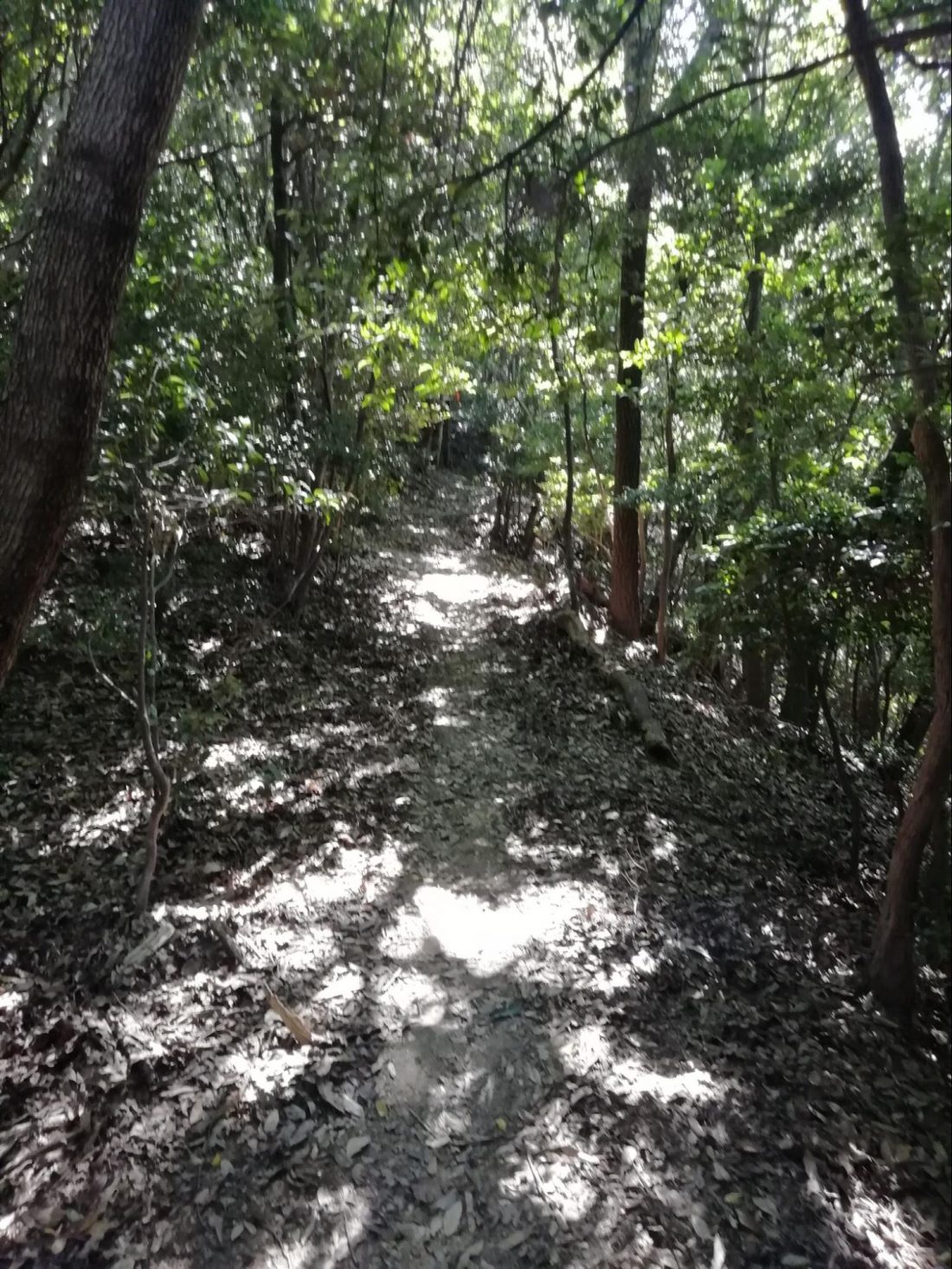
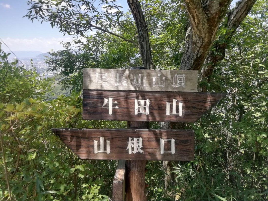
It’s important at this point to learn some kanji (often referred to as Chinese characters). Most importantly, please learn to recognize 牛田山, which is Ushitayama written in Japanese. The signs on the trail are 100 percent in Japanese. There is no English lettering to be found, and there are multiple branches of path to navigate ahead owing to the multiple trailheads mentioned above. Follow any arrow not pointing toward 牛田山 and you’ll likely end up descending to a remote part of the city on the opposite side of the mountains from Hiroshima station. As a rule of thumb, follow the straightest path, and also the most rising path. It’s not that difficult a course; I’m just putting a word of caution out there. There will be times along the way when you see narrower unmarked trails that seem to veer off – these are generally only one-person wide trails. While it’s possible some young trailblazers have tried to put in shortcuts, it’s just as likely the path will result in a dead end or have been made by some of the wild boars that live in the mountains. The boars are mostly nocturnal and not to be worried about, though. During my entire hike, I had trouble even spotting the many birds I was hearing. The largest thing I saw clearly were the many butterflies.
The stretch between Onagayama and Ushitayama is the longest run. It eventually takes long enough that you may start to fret, but it’s also the farthest from all city sounds, so just remember why you are there and you will begin to really enjoy it. I found myself wishing I was wearing the traditional historical fashion of Japan I always see in photos and period dramas, right down to the two-toed socks, sandals and walking stick. I could believe that the trail I was walking had been walked in a nearly identical fashion by travelers 400 years or more ago. It was a heavy feeling to have left not only the city, but the present time as well.
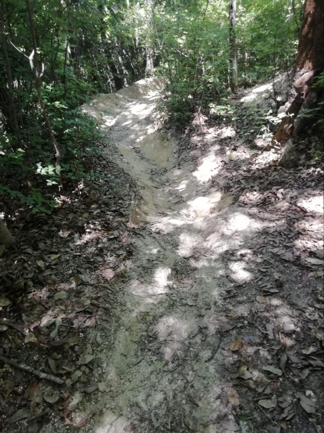
Much of the path, by the way, seems to have been formed by rainwater. When I wasn’t fantasizing about the past, I was having a chicken-and-egg debate with myself. Did frequent rains wear out a path over centuries that we humans have adapted for a trail? Or did human feet wear out a trail that rain now follows as a path of least resistance. Hmm…
Highest Point and Final Peaks
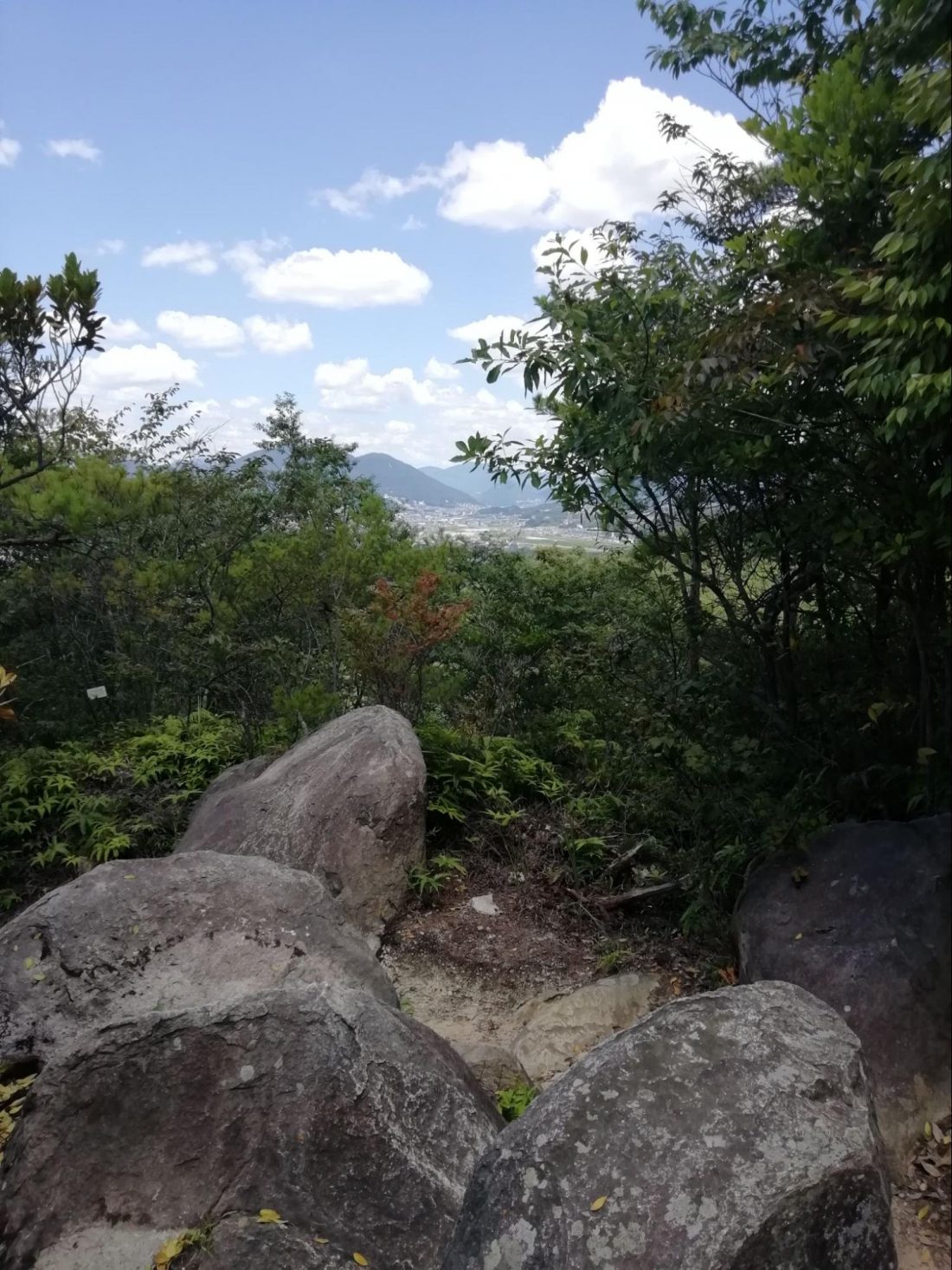
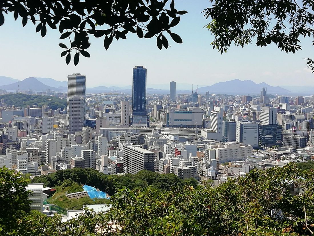
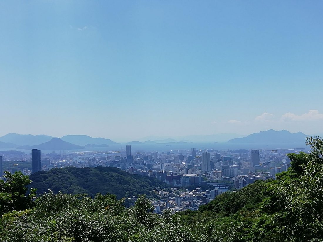
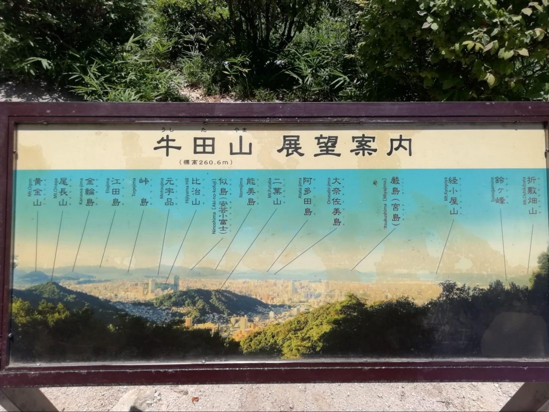
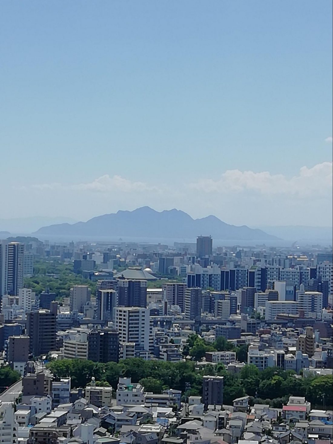
After one five-minute break on one of those tree trunk benches (I use how hot it was that day as my excuse), I reached the top of Ushitayama. There is a crudely constructed pavilion here complete with a calendar on the wall (I’m not really sure why) and a table to sit at, with a second picnic table under the open air. If you brought food, this is the perfect place to consume. Myself, I was there for the view only – and it’s fantastic. There is a greatly appreciated viewing guide posted as well, so you’ll know that you are seeing Miyajima and many other islands of the Seto Inland Sea, as well as the entirety of central Hiroshima City.
There is a signboard with an extensive amount of writing here (and on Mitateyama at the conclusion) telling some Hiroshima’s history, and also claiming the remains of Tosaka Castle (pre-dating Hiroshima’s city castle) can be found on Ushitayama, but there is truly not more than some stones that look like they may or may not have once been a foundation. In the same way, back near the Peace Pagoda is an explanation of a World War II-era gunnery watch point ruins, but that too requires great imagination to see what might once have been. The main historical point I enjoyed from these signboards was that the name “Hiroshima (廣島 – wide island)” was apparently chosen from this point–from these very peaks I was walking–as well as the exact location of Hiroshima castle. In fact, Mitateyama literally translates as “stood and saw” in honor of these facts, so doing this walk truly does mean striding exactly where Hiroshima’s founder Mori Terumoto did all the way back around 1588.
Descent and Three Moments of Joy
Moving from Ushitayama to Kandayama and Mitateyama is probably the easiest part of the journey. For one thing it’s mostly descent, of course, which is always easier. There are also more of the “hidden stairs” along the path here than at any other point of the trail. Hidden stairs are faux logs placed to provide stair-like footing, then covered almost entirely with dirt to make it seem like they are naturally occurring bits of wood that just happen to provide easy footage. Continue looking for signs pointing to 牛田 (Ushita), this time minus the 山 (yama), to end up at the most convenient trailheads to exit the mountains and head back into the city. It’s a simple descent so I was expecting it to be anti-climactic, and instead it hit me with three moments of joy in short succession. Surprise!
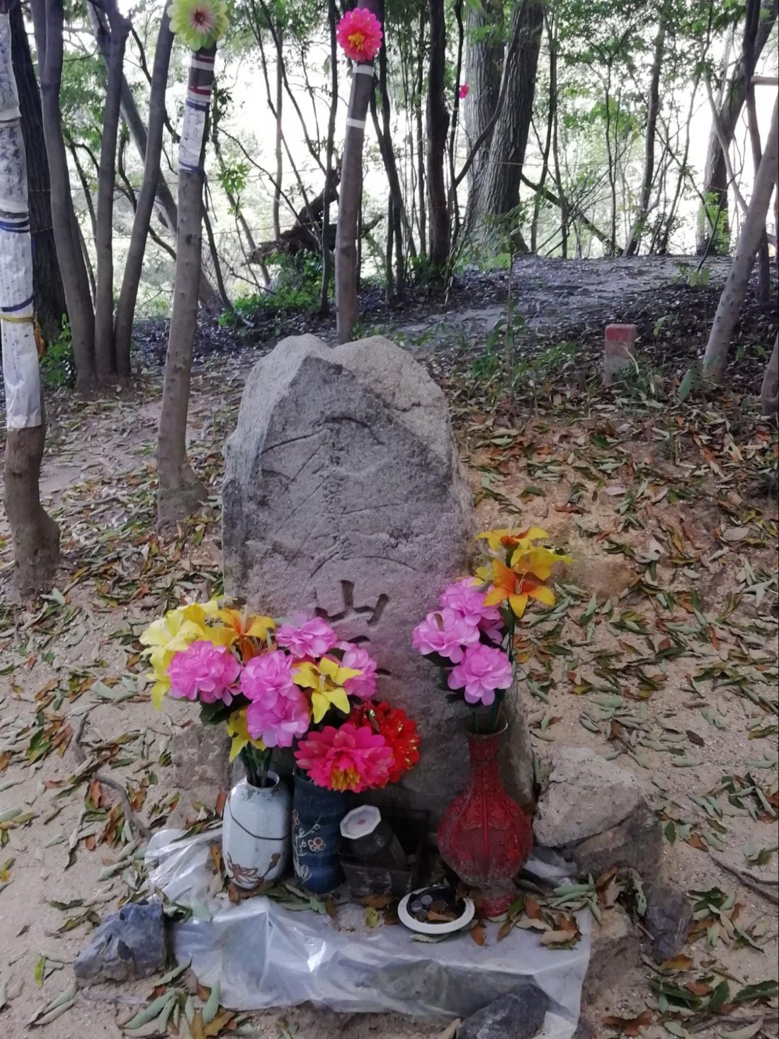
The first was the discovery of a flower tied to a tree marking a short side path that led to a tiny clearing with more flowers and a large stone with offerings in front of it. My best translation of the sign is that the stone was placed as a monument to the god of the mountain well over 200 years ago, and offerings hoping for wish fulfillment are still being made to this day. It’s not marked on any map I saw which made it super cool to stumble across.
The next moment was after descending just a little bit more and seeing off to the east, several kilometers away on a different peak, the Peace Pagoda again. I had not known it could be seen from this point. To realize I started there, then looked back from east of it, and was now looking at it from the west made me truly realize just how much of an excursion I had made and made me feel a nice glow of accomplishment.
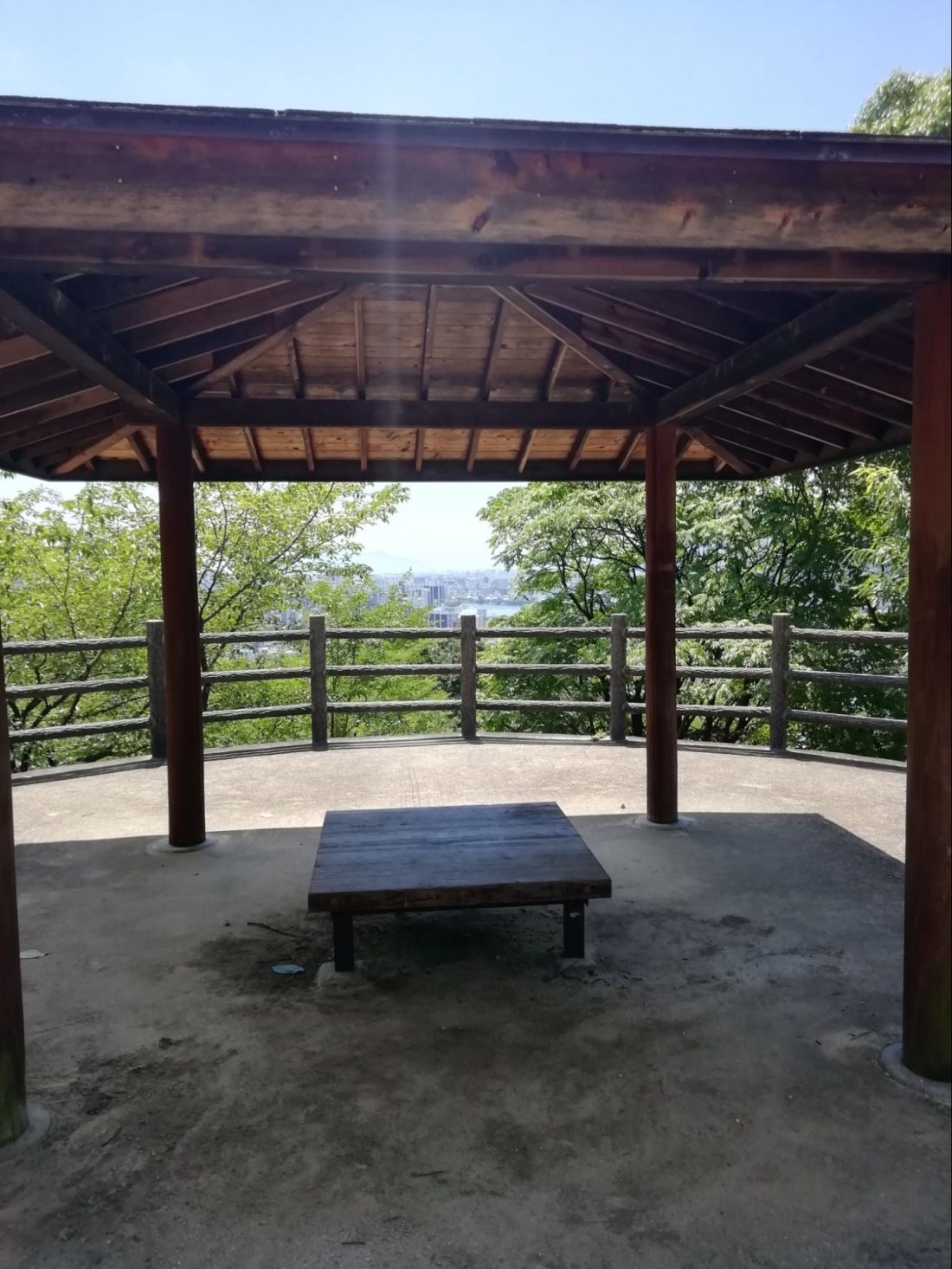
The third moment of joy came when dropping one more level down and finding a whole area of benches and pavilions with great views still far yet above the city, and yet also just about a 10- to 15-minute walk up from Hiroshima’s Higashi Ward sports center (called Big Wave) and the beautiful Bara Koen (Rose Park – a must see when the roses are in full bloom). I have been to both of those locations many times and never knew that 10 minutes away were these pavilions. I’ll be picnicking and relaxing there come autumn!
At the bottom of the hill there are buses and the Astram Line to take you back into the city. Starting in easy reach of Hiroshima Station and ending a 10-minute bus ride from downtown Hiroshima, it’s truly amazing to be able to do such a hike without ever having left city limits. This trail makes Hiroshima just that much more special.