100 Stories
Observing Mihara: Sunami Port’s Highs and Lows
054 / 100
Most of us appreciate a day being immersed in Mother Nature, but when it comes to the great outdoors, nature aficionados can roughly be lumped into two categories: mountain-type and sea-type. The designations are self-explanatory, but depending on what type of scenery travelers enjoy, the destination of the day will change to fit personal preferences. In the case of Hiroshima Prefecture, sea-type visitors are likely to opt for a coastal locale such as Kure or Okunoshima, whereas mountain-type tourists may choose to head inland towards Sandankyo or Yuki Onsen. However, there are several places in Hiroshima Prefecture where a compromise can be achieved, one of which is Sunami Port in Mihara, a city largely untouched by international tourists. Sunami (須波)–not to be confused with “tsunami (津波),” a tidal wave–is home to two mountains that will satisfy a hiker’s lust for climbing as well as seaside shrines and a beach that will captivate maritime fanatics all day.
Getting to Mihara is easy with JR, taking about an hour and a half via local train on the Sanyo Green Line and even less if traveling by Shinkansen. Upon arriving in Mihara, transfer onto the Kure Line to reach Sunami Station, the next station down. Being a relatively bare-bones station, Sunami Station doesn’t have a proper ticket gate per se, so make sure to walk down the platform until you find a scanner for IC cards, which marks the official exit. I made the mistake of walking down a slope and leaving the station without making my arrival known, which led to a convoluted explanation to the staff at Mihara Station later in the day.
Pre-Hike Surveying
That wouldn’t be the only mistake I’d made today, but before my next mishap, I first approached the Seto Inland Sea to watch the waves lick the seawall. It was high tide when I arrived early in the morning, and at one point along the road the water was splashing high enough to spill into the street. As I looked down to photograph the waves, I actually got some seawater on my shirt, but a phenomenal photo by which to remember it. I continued north until I reached the first tourist site on my list.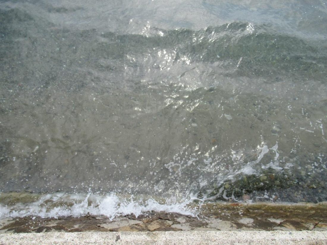
The Sunami Inari Shrine has several red torii by the side of the road, and one torii in the middle of the sea, just like on Miyajima, but smaller. At the time of writing, Miyajima’s torii was still undergoing renovations, so for me, Mihara’s floating torii was a welcome consolation. During high tide, visitors can gaze upon the humble yet majestic torii standing among the gentle waves, and during low tide (or even during high tide if you don’t mind get your feet wet) it’s possible to go down the stairs and touch the torii. Satisfied with my time spent admiring this seaside scenery, I proceeded to make preparations for my mountain expedition.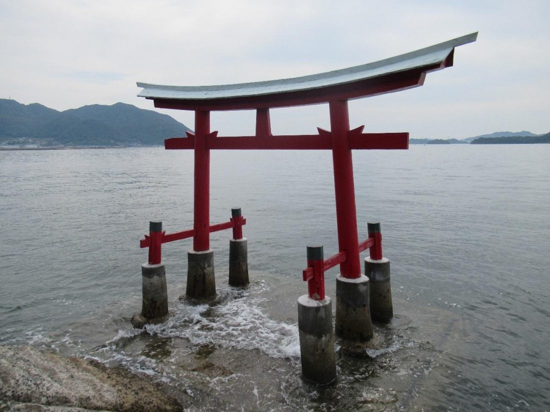
Two mountains tower over Sunami Port and offer spectacular views of the Seto Inland Sea: Mt. Fudekage and Mt. Ryuo. I walked back in the direction of Sunami Station and then continued south. There was a sign indicating the trail towards Mt. Fudekage, but before climbing I knew I would need provisions, so I walked past the sign and took a detour to nearby convenience store before starting my trek. With sufficient food and drink on me, I now felt comfortable conquering both mountains back-to-back and followed the sign to the trailhead. When I came upon what I thought was the start of the climb, I started a timer to see how long it would take for me to reach the summit of Mt. Fudekage.
Long story short, THIS IS NOT WHERE THE TRAIL BEGINS! I walked up this path thinking it was the mountain trail, complete with greenery, bugs, and a path that was seemingly made wet by a nearby stream. I followed this wet trail hoping to find a river, but instead found a dead end. According to my map app, this looked to be the right way, so rather than turn back, I decided to tough it out and climb onto the barrier and into the woods. As I brushed past young trees and spider webs, I realized that there was no way this could be the actual trail, and yet I could imagine no other way, so I trudged on.
I had no idea how long this wilderness would continue until I saw a car drive past beyond the trees. At that point I knew that’s where the actual trail was, but I’d have to hop the gap and go up a steep incline to reach street level. There was this big, gooey web standing in the way of clearing that gap, and while I’m not scared of spider webs, I was still hesitant to disturb the wildfire and destroy that spider’s hard work. Alas, there was no other way that didn’t involved going through a spider web, so I internally apologized to the spider before picking up a stick and the web. The strands didn’t snap, but just ended up sticking to the stick, so I hopped the gap while still holding onto the stick before gently placing it in a different tree, hoping that a new ecosystem would form there. I climbed up to street level, and sure enough, there was a sign indicating the trail up to Mt. Fudekage.
As I walked past the red sign, I noticed another sign with a message telling visitors not to litter, accompanied by a surveillance camera. When I approached the sign, though, I heard a voice come from the camera, which made me jump because I thought an officer was interrogating me live. However, upon listening to the words being repeated, I realized that the voice was a recording reminding people not to spoil the pristine nature with garbage. “Let’s protect the beautiful nature. Let’s stop littering and illegal waste disposal. Let’s protect the beautiful nature. Let’s stop littering and illegal waste disposal.”
Twin Peaks
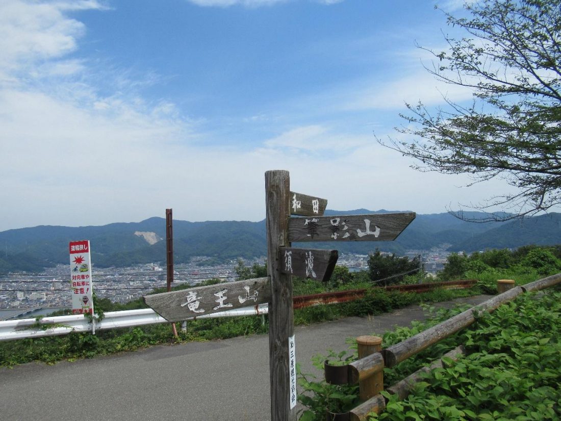
It was from here on out that my hike would begin in earnest, even though I forgot to reset my timer to account for the diversion. Long before reaching the summit of either Mt. Fudekage or Mt. Ryuo, I was already treated to magnificent vistas of the Seto Inland Sea and the myriad islands floating within. I then came to a fork in the road with a sign indicating four destinations: Sunami (須波), the direction from which I came, Mt. Fudekage (筆影山) to the right, Mt. Ryuo (竜王山) to the left, and Wada (和田) another path down the mountain leading to the town in the background. There’s also a public restroom, a vending machine, and benches to rest on at this point, but I was still in tip-top shape, so I turned right and continued to climb Mt. Fudekage.
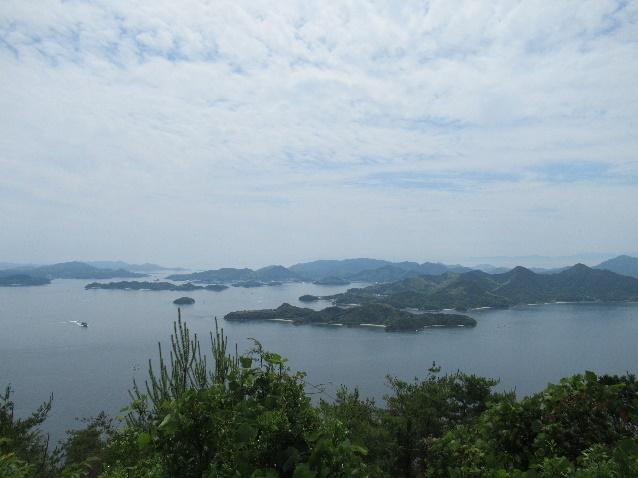
I eventually reached the observation deck at the summit, at which point I checked my timer to see that only a little more than fifty minutes had elapsed since I started on the wrong path up the mountain. The icing on the cake was that I was alone at this point in time, so I went up the stairs and leisurely caught my breath whilst marveling at the maritime landscape (pictured up top). There is a wide sign at the observation deck that indicates the names of notable islands and mountains in the distance so that visitors can know their location relative to other tourist sites in the vicinity. In due time, more tourists gradually showed up to take in the fresh mountain air, signaling me to get on with my journey.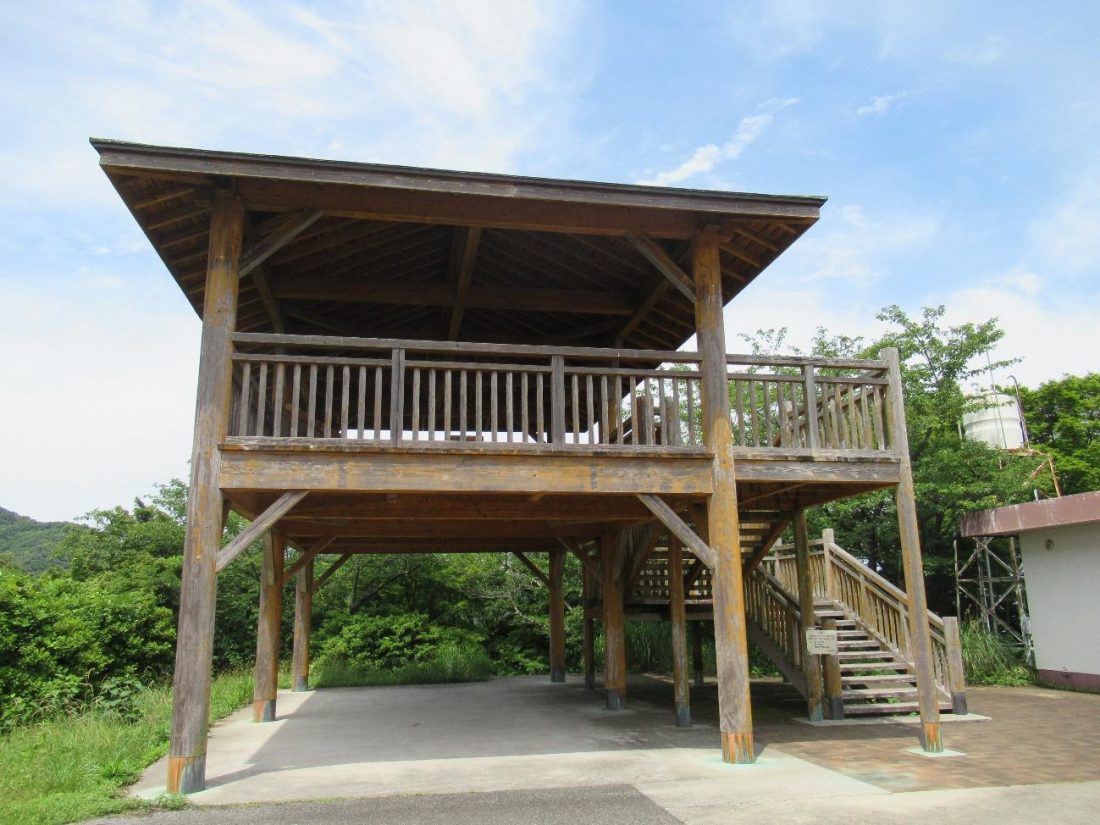
In addition to an observation deck, Mt. Fudekage also sports a separate observation square, a more secluded shelter where one can enjoy both a picnic and a vista similar to the one seen from the observation deck above. Since another couple was occupying this space, I briefly took my photos and searched elsewhere for a place to have a snack. The aforementioned fork in the road proved to be an ideal spot to refuel and recuperate.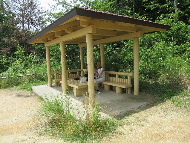
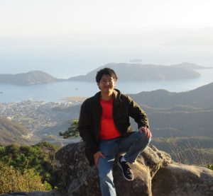
I then made haste towards the second peak, Mt. Ryuo, and although the walk felt long, the path was straightforward, accompanied by signs that show the way to the observation deck. Mt. Ryuo is the higher of the two peaks at a height of 445 meters, as opposed to Mt. Fudekage’s 311, but the view remains largely unchanged. It was almost noon by the time I got to the summit here, and thus decided to make my visit here quick in order to grab lunch at a decent hour.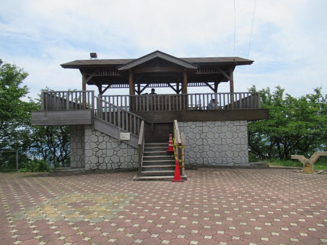
Moment of Joy: Initial Familiarity
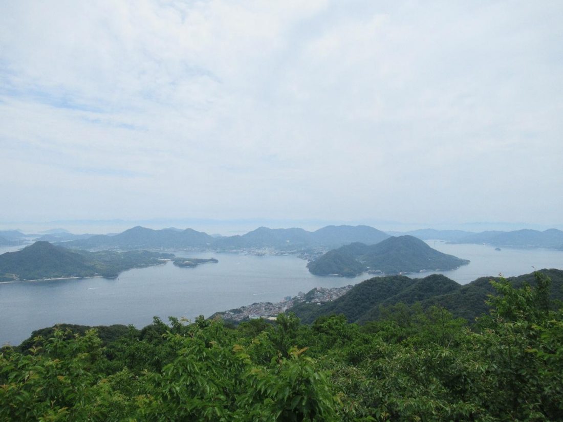
This was the first time I had been up Mt. Fudekage and Mt. Ryuo, yet upon seeing the signs pointing out distant landmarks, I got this feeling like I already knew the views from up here. In the middle distance were islands along the Shimanami Kaido that I cycled a few years back. The fuzzier green mountains in the back of the horizon are actually on Shikoku, including Mt. Ishizuchi in Ehime Prefecture, which I had hiked the year prior. All these reminders of my past adventures instilled an air of familiarity and made Mihara a more relatable city to me.
Chicken In, Don’t Chicken Out!
I made my way back to the fork and took the last path towards Wada, with the hope of finding a meal in town. My aim was to find a place that sold Miharayaki, a regional variation of okonomiyaki that includes the organ meats of chicken since lots of chickens are raised here, making for fresher offal. Stores that sell Miharayaki can be found all over the city and the bulk of them are around the city center, but according to my research, the restaurant closest to me at the time was near Wada, thus prompting my choice of descent. The way to the restaurant has its share of twists and turns so I recommend using a map app, but I’ll try to provide some more detailed directions here.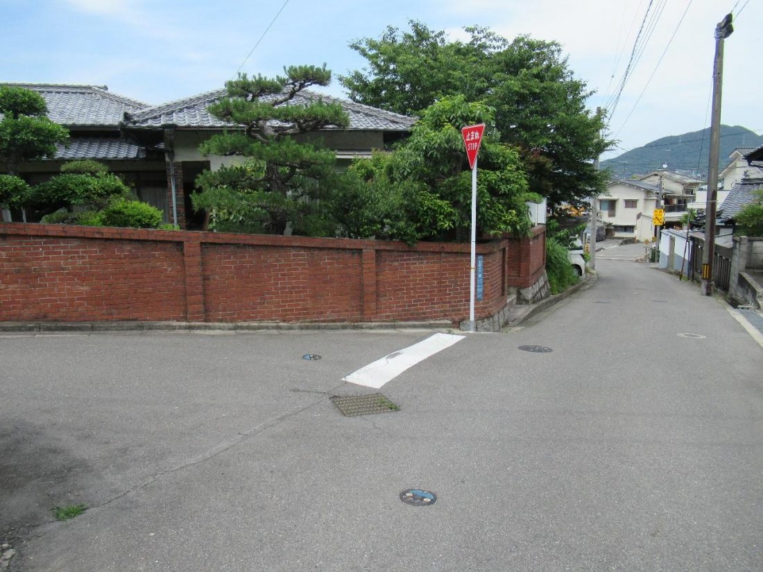
After descending the mountain and re-entering civilization, I walked past some quaint houses and gardens, then hung a left at this intersection. From there I turned right, walking down a slope, and took a left up until the road merged with a bigger and busier street that leads to a bridge. I walked up to the bridge, but rather than crossing, made two right turns to find ふくちゃん (Fukuchan), an eatery that serves up Miharayaki, at the end of the street on my right. It took some time to reach the restaurant, but thankfully, I still made it in time for their lunch business hours.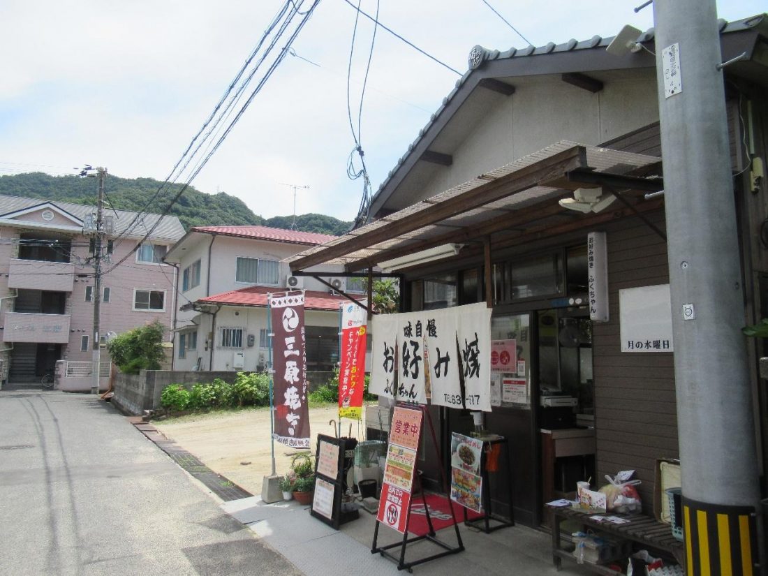
There are a couple more differences separating Miharayaki from standard Hiroshima-style okonomiyaki. For one, the standard recipe more resembles an Osaka-style okonomiyaki in that noodles aren’t included by default, and adding soba or udon makes it a modan’yaki, a name I typically associate with the Kansai variant of okonomiyaki. Another way in which Miharayaki from its Hiroshima counterpart is that once the noodles are piled on, the entire piled is chopped up with spatulas and stir-fried like yakisoba. Witnessing such a cooking procedure in this prefecture was so out of the ordinary for me that I felt the need to whip out my camera to record this peculiarity.
I got my Mihara-style modan’yaki with chicken gizzard (grilled separately next to the pile), squid, and mayonnaise toppings. Though I’m not a fan of organ meats, it would’ve been remiss of me not to try such an essential component of the Miharayaki I walked so far to eat, so I decided to be a little less of a chicken and give gizzards inside my okonomiyaki a chance. The gizzards were rather firm and had bits of hard cartilage attached, but nothing that was too hard to chew. Since they were thinly cut, they ended up having the same texture as the squid, and if I didn’t pay too much attention to the bites I was putting into my mouth, it was a bit of a challenge to truly know which animal I was eating. As expected, the chicken gizzards did taste fresh, and by the end of my meal, I felt like my gastronomic mind had been opened up just a little bit more.
Back To the Sea
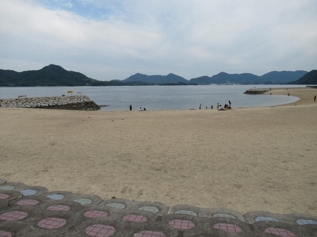
I had had my fill of mountains for the day, but barely toured the coast, so I saddled up and made the journey back over Mt. Fudekage back to Sunami Port. The weather was lovely but scorching hot in early June, which meant I had to stop here and there to refresh myself with ice cream and soft drinks in order to keep going. After descending from the mountain (using the correct path this time), I made my way south towards Mihara City Sunami Seaside Park, which is perhaps the highlight of this area, at least at sea level. It takes twenty-something minutes to reach this public beach on foot, but at this point in the day it felt like forever. Having effectively hiked Mt. Fudekage twice, I was developing blisters in my feet, and my legs were so exhausted I was walking with a limp. I breathed a sigh of relief when I finally made it to my last stop of the day.

The waters around Mihara City Sunami Seaside Park are crystal clear, and the beach is a hotspot for locals to bring their families and pets, even in the late afternoon when only a few hours of daylight remained. There was a secluded area around here with a staircase leading down to the water where I retreated to rest and gulp down another cold beverage. Feeling recharged once again, I continued toward the sandy beach, which was occupied by locals swimming, playing sports on the sand, and walking their dogs. Further along were the showers, changing rooms, and kiddy pool, and past that was another sandy beach, as if one wasn’t enough. In addition to being family-friendly, the beaches here also have ramps in addition to the colored steps, making the park barrier-free and truly a leisure spot for everyone.
If you search high and low all over Hiroshima Prefecture, you’ll find an abundance of good trails to tackle and miles of coastline to marvel at, but only a select few pockets in the prefecture have both that can be enjoyed in the span of a day. When it comes to tourism in Hiroshima, Mihara is one city that is often overlooked or dismissed, but Sunami alone justifies the voyage by train and may pleasantly surprise even tourists from abroad. I also recommend checking out the area around Mihara Station for the castle ruins and plenty more interesting establishments dishing out the regionally distinct Miharayaki. Whether you like sights at high or low elevations, one thing that’s certain is that a trip to Sunami will leave tourists with memories full of high points that resonate with the frequency of the tides that constantly lap at Mihara’s shore.