100 Stories
Hiking on Innoshima: The Shimanami Kaido on Foot
057 / 100
Ah, the Shimanami Kaido, the nationally-renowned scenic route connecting Hiroshima and Ehime Prefectures that doubles as a physical challenge for the adventurous. Those who must commute via that road will most likely drive, and going by bicycle is the most recommend method for tourists, but the thought of walking the Shimanami Kaido (even partially) doesn’t cross too many people’s minds. It can definitely be done as the cycling road has space for pedestrians, and the only caveat is the grueling length of the journey. According to Google Maps, hopping over the six islands of the Shimanami Kaido from Onomichi, Hiroshima, to Imabari, Ehime, would take at least 13 hours on foot, assuming the traveler walks nonstop, and takes no time out to eat, drink, use a restroom, or even stop to admire the scenery. After factoring in meals, sightseeing, and miscellaneous breaks, the total would be closer to 20 hours, at which point, you might as well spend the night somewhere in the middle to recharge your batteries. That being said, I tend to think of traversing the Shimanami Kaido on foot to be a two-day ordeal, and seeing as a walking adventurer is more likely to appreciate individual sights on each of the islands than a cyclist who whizzes past them, I highly advise tourists to walk across at least some of the islands.

Every island has interesting stuff to check out, but since there’s so much to see that each island could have its own article, this piece will be dedicated to Innoshima, the second island south of mainland Onomichi (yet still within Onomichi’s city limits) on the Shimanami Kaido. Not only can visitors marvel at the Seto Inland Sea while fervently pedaling along the cycling road, but they can also partake in trekking around the hills, nab some sweet photos of Innoshima’s mesmerizing views, and even pick fruit from an orchard when the time is right. What’s more, access to Innoshima via public transportation is readily available, so it isn’t necessary to walk all the way from the Japanese mainland. One can either take a ferry to one of various islands straddling the border between Hiroshima and Ehime, or get on a bus bound for the island one wishes to visit. Regardless of where one chooses to alight, the key to making the most out of Innoshima is to try walking all over the island rather than simply speeding through to the next one.
Visitors may be at a loss as to what sights to choose, so as a springboard, allow me to introduce the “Eight Views of Innoshima.” These vantage points scattered all over the island afford tourists with breathtaking landscapes, usually of other islands floating in the Seto Inland Sea. Those wishing to hit up all eight are best off driving or at least cycling around the island, though it can be done on foot. According to the numbers on my makeshift map of Innoshima, the eight views are:
- 白滝山 (Mount Shirataki)
- 水軍城 (Suigun Castle)
- 六松公園 (Rokumatsu Park)
- 因島公園 (Innoshima Park)
- 大浜埼灯台 (Ohama Lighthouse)
- 大浜海岸 (Ohama Coast)
- 梶の鼻 (Kaji no Hana)
- 水軍スカイライン (Suigun Skyline)
Prior to setting off for Onomichi and Innoshima, I had plotted to see all eight of these lookouts in one day, so I plotted my course in red pen and research an optimal course for visiting them. I then realized, though, that swinging by all of them in one go would take around nine hours or so, and that’s not counting time spent taking breaks and getting lost. It was clear that there wouldn’t be enough daylight–as I was visiting in early September–and that I wouldn’t have the willpower for such a grueling march that would take away from the fun. As a result, I narrowed my itinerary down to two sites (Suigun Castle and Mount Shirataki), but would still begin at the same point that I marked on my map, which was 土生港 (はぶこう – Habu Port) on the south side of the island. To that end, I took an orange Honshi bus from just outside Onomichi Station all the way to the terminus that was Habu Port, at which point I would gradually progress north towards the points of interest.
Southern Innoshima
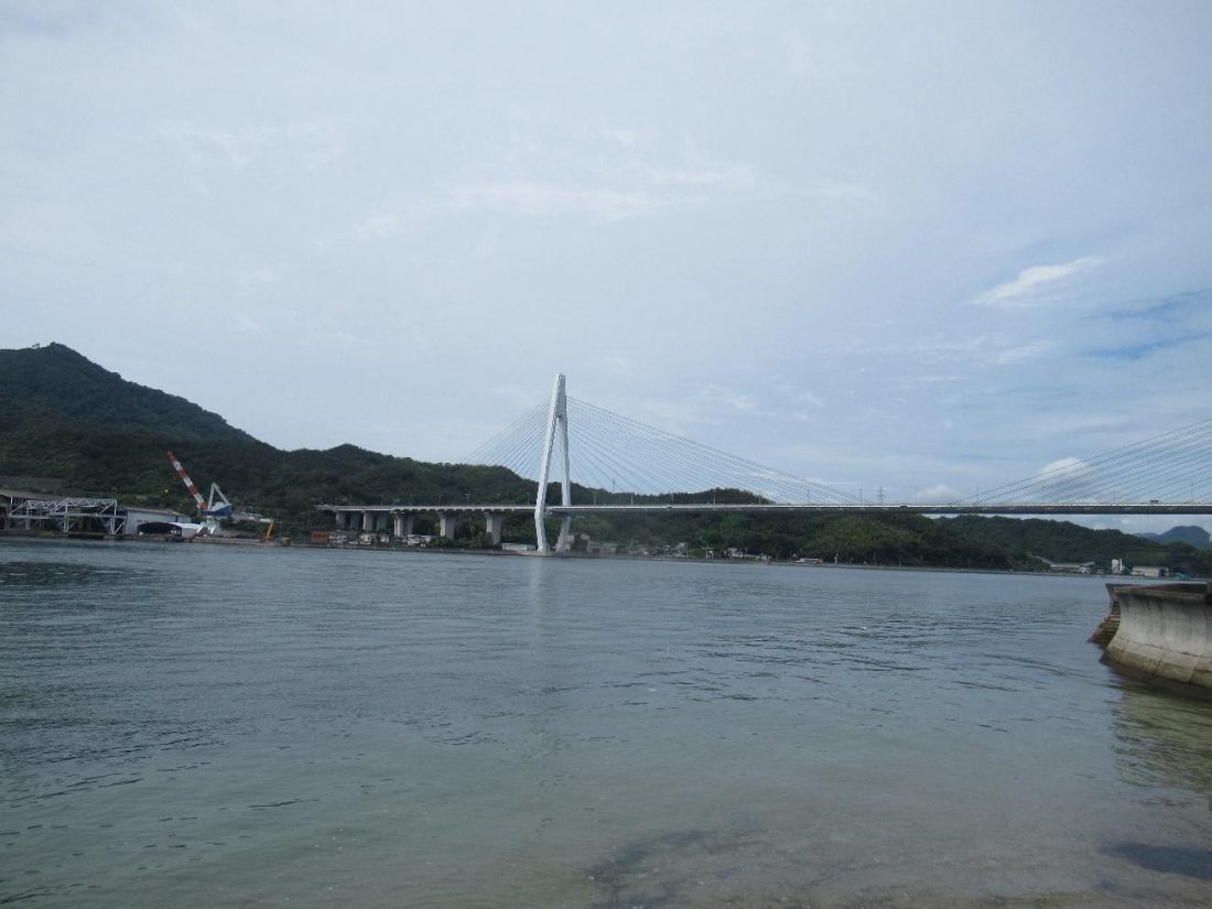
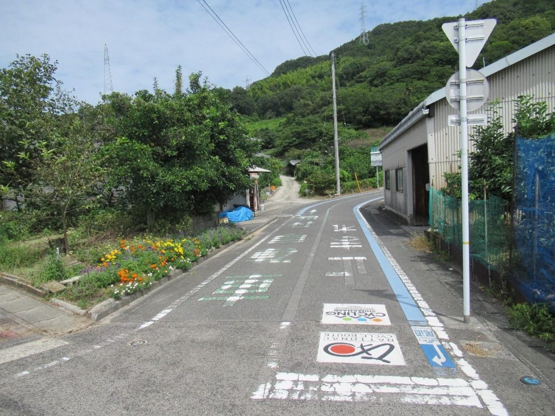
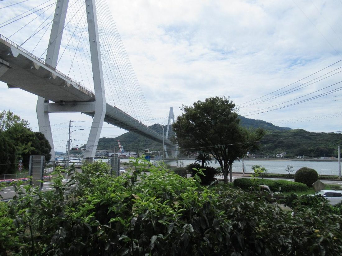
After I got off at the last bus stop, the bus drove off and I began my trek around the island. The first task was to make it to Ikuchi Bridge, which links Innoshima with Ikuchijima to the south. Being on a small island with not too much to see besides small stores and the sea, sometimes the walk feels like it takes forever, but I found that the occasional convenience stores dotted about the island make for good landmarks for gauging my progress and reorienting myself when I stare at my smartphone’s GPS system. Eventually, Ikuchi Bridge came into view, and when I reached a power plant on my left, I crossed the street to the sea side and snapped a gorgeous photo of the bridge, towering majestically above the sea.
Continuing on, I had the idea to take a not-so-short detour into some of the surrounding hills, as it was still far from lunchtime. The roads off the main path wind this way and that, so if you’re looking for a certain locale, your GPS system will be a lifesaver. It’s basically a bunch of people’s residences around these parts, and if you’re efficient with your time and know the roads well, you can reach Rokumatsu Park from here. I, on the other hand, got lost one too many times, so I called it quits and headed in the direction of Ikuchi Bridge. There were bound to be a variety of restaurants where I could fuel up for beginning my hike in earnest. On the way, I passed by the entrance to the cycling road that would take me onto Ikuchi Bridge, but I had wasted too much time in the hills to go up onto the bridge, so that would just have to wait until another day.
A Substantial Repose
I didn’t actually plan on visiting a particular restaurant, and I was counting on the eateries under the bridge not requiring reservations (big mistake). I searched here and there around the area, and even called in advance to ask if I could eat without a reservation. One place told me that without a reservation, I could test my luck, and if a party happens to leave at the same time I arrive, then they could accommodate me. This establishment went by the name ことのは (Kotonoha), and was a small restaurant slightly tucked away from the main street by the sea. I turned right just after passing under the bridge and crossing the busy road, and my timing honestly couldn’t have been better, for not long after reaching the front door, one group was on its way out.
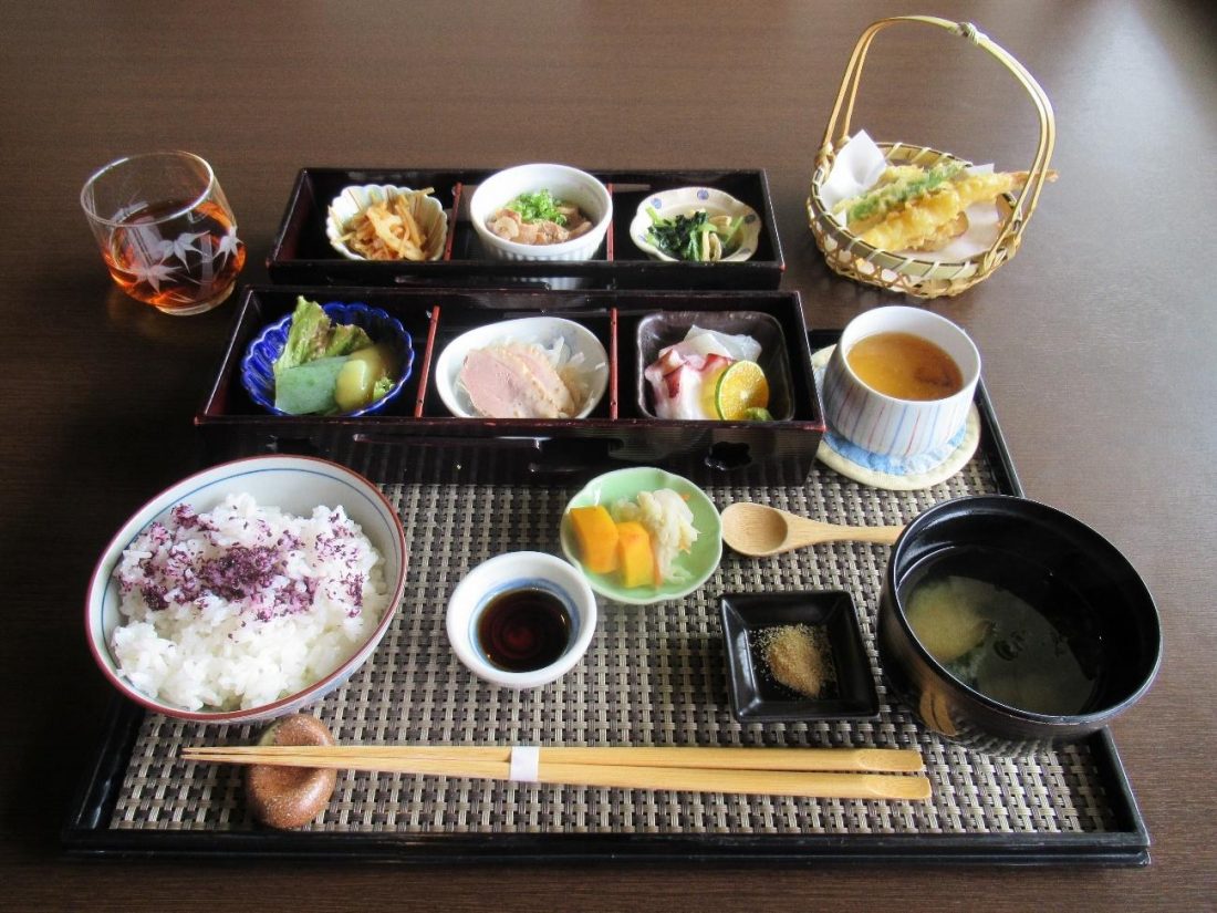
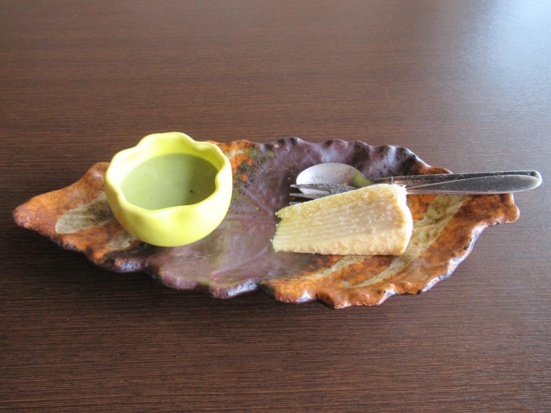
The staff promptly cleaned a table and showed me to my seat. Kotonoha offers a set lunch plan whose contents differ daily, so after sitting down, the only thing I had to do was wait for my food to arrive. In the meantime, I could gaze out the window at the colossal Ikuchi Bridge stretching all the way across the Seto Inland Sea to Ikuchijima, a sight I would return to several times during my meal. The servers brought out my food in separate bursts, but when everything showed up, it was a marvel to behold! Steamed rice covered in furikake was accompanied by Japanese pickles, miso soup, tempura, and a plethora of main dishes, including sashimi, steamed chicken, green konnyaku, root vegetable kinpira, simmered pork with tofu, and some boiled greens. For dessert, I had a green tea pudding with azuki beans underneath, paired with a millefeuille cake, served with a tall glass of iced coffee.
Moment of Joy: Savoring the View
Having so much to eat made for a long meal, and in between bites, my gaze would always return to the window. The sights and sounds coming in were soothing, and the greenery right in front ensured I could stare out without the worry of anyone staring back. I knew I had a long slog ahead of me so I tried to eat as quickly as I could, but time just passed more slowly inside this eatery, and I was thankful for it. I honestly didn’t want to leave so soon, but when the food was all gone, I knew I had to be too.
Maritime Castle
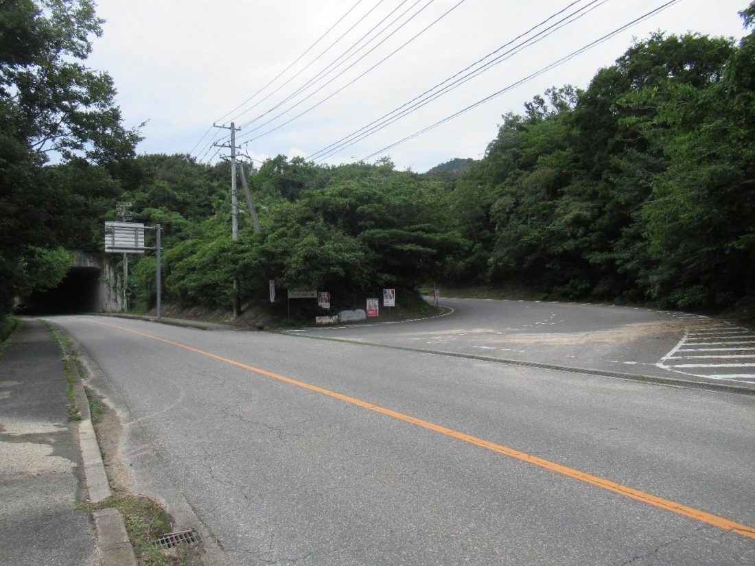
Before long, I was on the road again, and I trudged onward, with the Seto Island Sea on my left. When I came to a sign directing me to Suigun Castle, I turned right and advanced up the slope. I stayed on the dedicated pedestrian walkway, but eventually, I came to this fork in the road. The path on the right lead to a tunnel, where there is only room for cars to drive through, so the only way for hikers like myself to safely cross was to take the left path and walk over the tunnel.
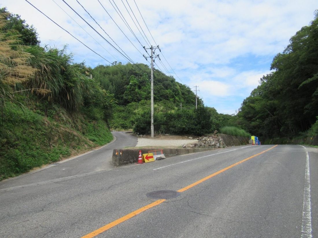
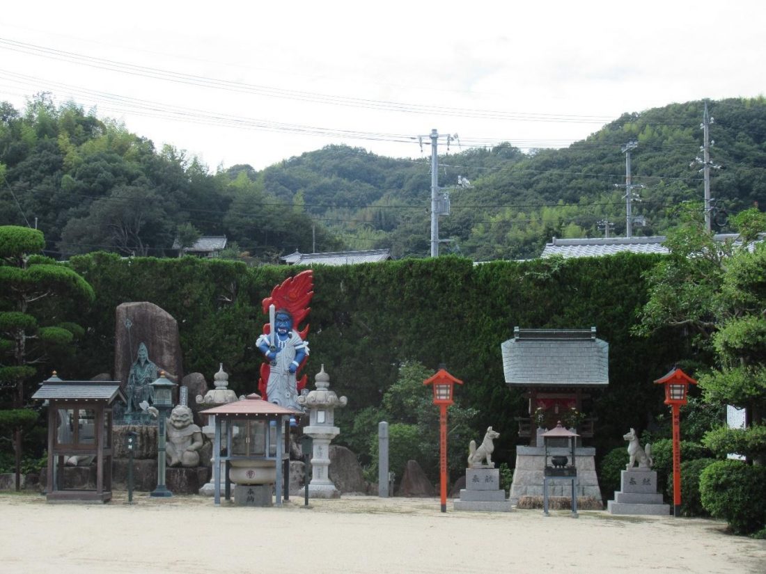
Just a word to the wise: at this point, GPS becomes crucial, because there is a slew of small paths that seem to lead to Suigun Castle but actually don’t. In general, try to stay on the widest street, and when at a crossroads, don’t always take the path going up, because you just might end up being greeted by some wary dogs who are simply guarding someone’s private property. You’re going to walk past a whole lot of houses, but some landmarks that stood out were a short underpass tunneling through a section of freeway, a humble temple with a blue guardian statue, and convenience store once again, as the small road merges with the freeway. Pedestrians have it a lot harder than motorists and cyclists since we have to find alternate routes often, but our journey just might be all the more enriching for it.
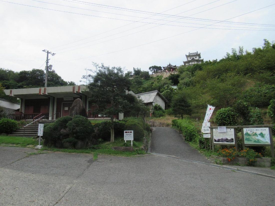
After a while, I finally made it to the entrance of Suigun Castle, which was marked by a watchtower-shaped sign. The grounds of the castle are vast despite the main keep not being so large, but shortly after entering and before climbing up, there’s a vending machine in the parking area. I strongly recommend buying a drink from here before departing again since this will be the last vending machine for a good while. When I finally reached the castle keep and museum, I was dismayed to find everything closed today, but I took out the time to sit on a bench, hydrate, and rest my weary legs. The journey here was long, but believe it or not, it was going to get harder from here. At the very least, I got to check off one of the spectacular views, and as for weapons and armor in a castle, Hiroshima Prefecture’s got other places with similar treasures, so Suigun Castle being closed wasn’t a big loss in my book.
Mount Shirataki
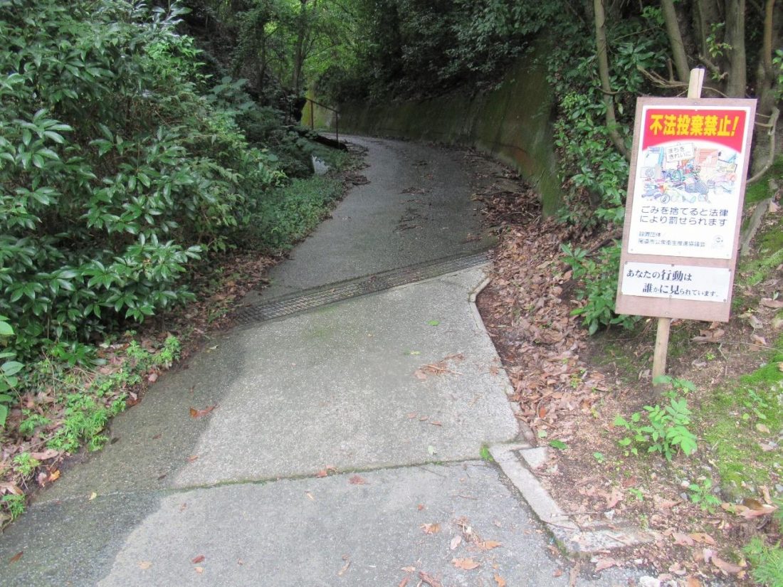
I left the grounds of Suigun Castle and proceeded north. I came upon the entrance to a highway that forbade pedestrians from walking (there was signage in Japanese and English), so my only other option was to cross that street and continue straight, where I would be met with another tunnel. Pedestrians are allowed to walk through this one, but I learned through trial-and-error that it’s the wrong way. To get to Mount Shirataki, one must actually go right at this fork and climb up. The path will eventually run parallel to and have hikers overlooking the highway where no one walks.
On the path, there are several skybridges jutting out the left, but in order to access Mount Shirataki, you’ll want to take one marked 大浜こ道橋 (おおはまこみちはし – Ohama Little Street Bridge). After crossing, turn right and weave through some vegetation before coming to a four-way intersection. Turn left here to begin a climb up a road marked with a sign telling visitors not to litter.
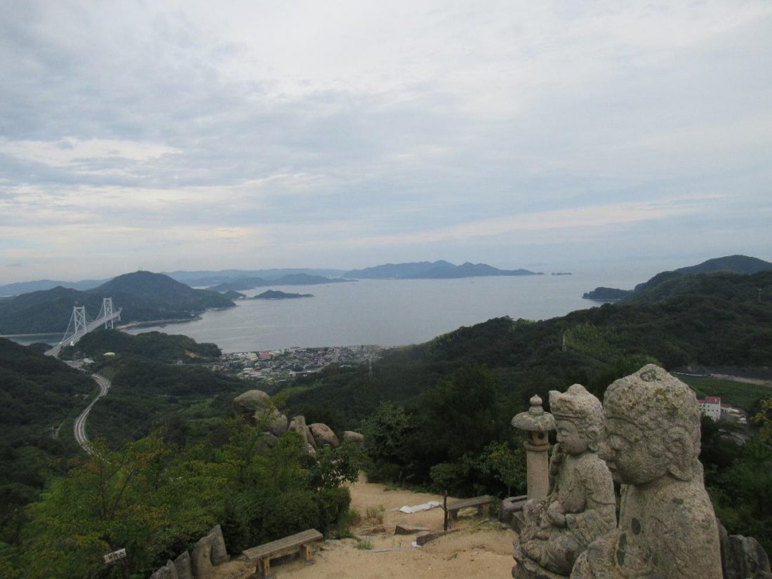
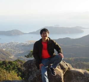
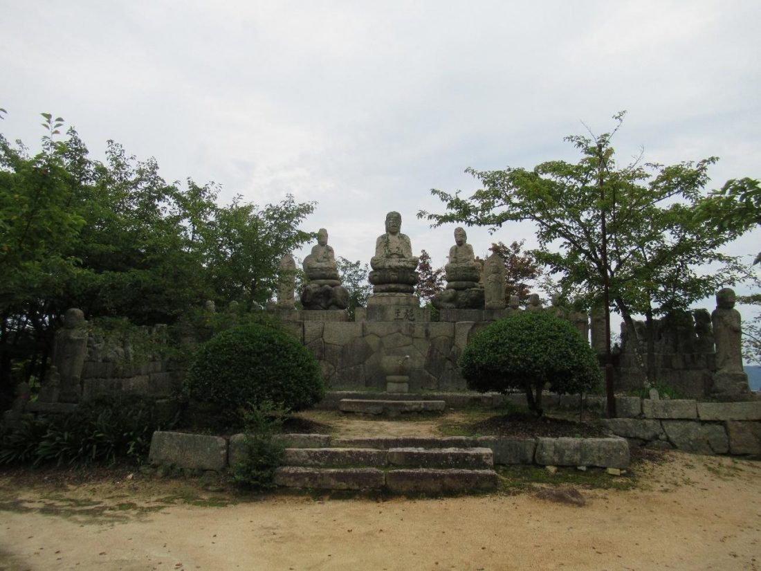
At the top of this incline with a roundabout with paths leading in four directions. From the path I had just ascended, the way to the top of Mount Shirataki was on the left at approximately eight o’ clock, so to speak, and clearly marked with a sign. Going up this incline takes tourists to the Gohyaku Rakan, a collection of about five hundred Buddhist statues that watch over this place.
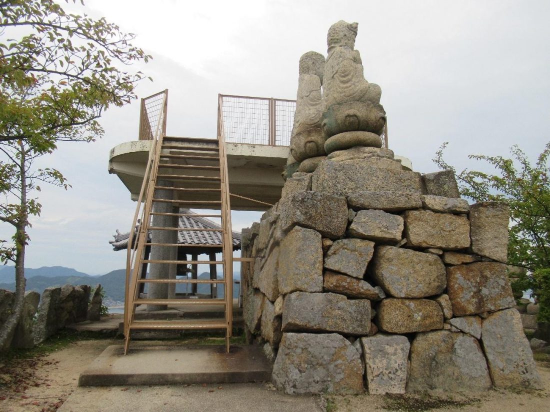
Even this close to the summit, the path splits a couple times, but all paths lead to the same goal: the observation deck at the top. It’s pretty bare-bones in presentation, but once at the top, there’s incredible scenery to be taken in no matter where one looks. Mainland Onomichi is to the north, Fukuyama is eastward, Mihara lies slightly west, and looking south, one can see the rest of Innoshima and subsequent islands on the Shimanami Kaido.
As I was hiking on a time limit, I shortly made my way back down to the roundabout, to take another path that would lead to a bus stop on the north side of Innoshima. What I didn’t realize was that the path that was supposed to take me there was closed, leading me with only one other path to take. According to my map application, I could go down that path to sea level and take a ferry back to the mainland, so all hope wasn’t lost. I went down that road until I reached a local middle school, walked around the building, crossed the street, and passed a gas station before I finally came upon the port. It was desolate, and virtually no one seemed to be waiting for a boat, so I briefly thought there was some sort of mistake.
I thought I was done for until a yellow water taxi came to the rescue, albeit behind schedule. At this time, there were also other locals who were awaiting the boat, letting me know that I had nothing to worry about the entire time. I got on, paid the fare onboard, and leaned back into my chair, relieved to be able to get back to Onomichi Station, and ultimately, Home Sweet Hiroshima.
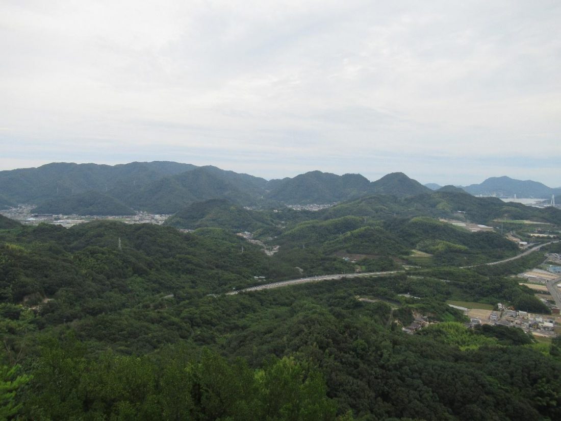
Even with only two tourist sites in my itinerary, traversing Innoshima–only one-sixth of the Shimanami Kaido–ate up an entire day, and in retrospect, going this slowly is what allowed me to enjoy the island as much as I did. When I was looking south from the observation deck on Mount Shirataki, being able to spot Suigun Castle (dead center in the photo above) and Ikuchi Bridge (on the right-hand edge) really put into perspective how far I had hiked. If I ever have time, I’d like to see the other six views of Innoshima, even if I have to take the bus or rent a bicycle, and beyond that, there are at least five more islands to explore! Next time you consider traveling around the Shimanami Kaido, rather than see it all in one go, take the time to get to know each island individually. After all, if even half a day can be dedicated to each island on the cycling road, you’ll have six times the fun!